Broad Street South Philly has changed dramatically over the past several decades. Often called the spine of South Philadelphia, Broad Street remains one of the city’s most important transportation, commercial, medical, and neighborhood corridors.
Local South Philly view: I grew up one block off Broad Street in South Philly at 15th & Shunk Street. These aren’t “pins on a map” to me—this is the Broad Street I walked, crossed, shopped, and lived around.
Broad Street was never just a road. In South Philly it was the spine: the line you crossed for the store, the dentist, the library, the pharmacy, the subway, the hospital, the bar, and the funeral home. When you grow up here, you learn Broad Street the way you learn family routines—you don’t “navigate” it; you know it.
That’s why this Broad Street South Philly series matters.
Because the biggest risk on Broad Street today isn’t just speed. It’s familiarity—the “I’ve crossed here my whole life” assumption—colliding with a corridor that has changed in ways people don’t fully appreciate until the moment something goes wrong.
Answer Block:
Broad Street South Philly Reality (Shunk to Snyder)
Broad Street between Shunk and Snyder used to function like a walkable neighborhood main street with lighter traffic, fewer interruptions, and clearer sightlines. Today, the same stretch is loaded: heavy traffic, constant curb activity, funeral home surges, rideshare stops, and hospital traffic. Even worse, the center lane between northbound and southbound traffic has become packed with vehicles, and drivers often stop in mid-traffic to pull into or back up into spots. That combination can collapse visibility for pedestrians and create sudden braking and forced merges for drivers. The danger often isn’t reckless pedestrians—it’s a corridor that can “change shape” in seconds.
Rideshare help
If your accident involved Uber, Lyft, or another rideshare vehicle, you can learn more about your legal options by visiting The Oakes Firm’s Philadelphia rideshare accident lawyer page, which explains how rideshare accident claims work in Pennsylvania.
Key Takeaways:
Broad Street South Philly Then vs. Now
- Then: Broad (Shunk → Snyder) had much less traffic, and the rhythm of the street was built around walking and local errands.
- No chain pharmacies: You had local pharmacists—and they could actually make up/compound prescriptions.
- Neighborhood banking: A Savings & Loan at Broad & Porter ran Christmas Clubs, where families deposited a set amount weekly to save for gifts.
- Now: curb parking is packed, and the center lane often fills with cars, creating sightline problems and risky mid-traffic pull-in/back-up maneuvers.
- Funeral home surges: Carto, Gangemi, Grasso, Stolfo, Monti-Rago bring predictable waves of arrivals, double-parking, lane pinches, and blocked pedestrian visibility.
- Hospital zone: Methodist Hospital runs from Broad & Ritner to Broad & Wolf, with doctors’ offices across Broad—adding constant crossings, urgent turns, and drop-offs.
- Common outcomes: pedestrian strikes, rear-end crashes, sideswipes, and near-misses that happen daily.
Vision Zero PHL + the High Injury Network: Why This Cluster Is Predictably Dangerous
Philadelphia’s Vision Zero PHL program uses a data-driven map called the High Injury Network—the small percentage of streets where a disproportionate share of the city’s traffic deaths and serious injuries occur. In other words, the City itself recognizes that certain corridors “carry” the risk because of geometry, volume, turning conflicts, and visibility—not just individual behavior. That’s why this Broad Street / Moyamensing / Oregon cluster matters: when you layer school pick-up surges, hospital traffic, buses, and Funeral Parlor Row onto a corridor that already functions like a high-conflict network of islands and turning lanes, you get a street environment where near-misses and serious crashes aren’t “random”—they’re predictable.
Philadelphia’s Vision Zero program flags South Broad Street and Oregon Avenue as part of the City’s High Injury Network focus for South & Lower South Philly—meaning this corridor is recognized as a place where serious crashes concentrate, and where safety projects are prioritized.
Broad Street crashes rarely happen in isolation. Whether the incident involves a pedestrian, rideshare vehicle, delivery driver, funeral procession traffic, or a rear-end collision caused by blocked visibility, understanding what to do immediately after a crash can make a significant difference. Before continuing, readers may also want to review our complete Philadelphia Injury Playbook, which explains the steps to take after an accident anywhere in Philadelphia.
Philadelphia Injury Playbook: What To Do After an Accident in PhiladelphiaBroad Street South Philly Walk North (Shunk to Snyder)
You can explain Broad Street South Philly in the most honest way by walking it—northbound—block by block.
Today’s Broad Street Watch-For Checklist
Use this as the quick “street reality” snapshot of why Broad Street is harder now:
- Center lane filled with parked/staging cars that block sightlines
- Drivers stopping in moving traffic to pull in or back up into spaces
- Double-parking spikes during viewings and funerals on Funeral Parlor Row
- Sudden lane pinch points that trigger forced merges and rear-end chains
- Hospital and doctors’ office crossings (patients, staff, rideshare drop-offs)
- Familiarity trap: people crossing as if Broad still behaves like it did decades ago
Broad Street South Philly: Shunk Street to Porter Street
When I was younger, Broad Street between Shunk and Snyder had much less traffic. It felt wide and readable. Stores served the neighborhood without needing parking lots. People walked because that’s how the neighborhood worked.
Food Fair at Broad & Shunk (no parking lot, all neighborhood)
The Food Fair sat on the corner of Broad and Moyamensing and went almost to Shunk Street. Its entrance was on Broad Street. There was no big parking lot because it wasn’t designed for outsiders driving in—it serviced the local neighborhood.
People walked. People pushed portable pull carts, you know the ones that had two wheels and popped open. Some people hired a local kid to carry bags home. Kids would wait inside the grocery store and ask if the shopper needed help with their bags getting them home. Groceries were packed in brown paper bags, and if they were heavy they’d double-bag them. That detail matters because it tells you what Broad Street was designed for: steady foot traffic, predictable movement, and neighborhood-scale errands.
Across the street from Food Fair was the Oyster House, a seafood takeout. We knew Mrs. Dennenhauer, who worked there. She lived on Hicks Street and also had family on Rosewood Street. That’s what “local” meant: you didn’t just recognize the business—you recognized the person behind the counter.
Broad & Shunk: the dentist corner
Broad & Shunk always had a dentist office on the corner. My mother, who was born in 1927, she lived on the small street, when she was 17, she worked for the dentist who ran his practice there. Years later it’s still dental—now expanded into oral surgery. That corner stayed “the dentist corner,” even as the neighborhood changed around it.
The Food Fair Corner Today: Charter School Pickup Chaos + the Moyamensing Cut-Off
Today, this stretch has a completely different pressure point than it did when the Food Fair anchored Broad & Shunk. The Philadelphia Performing Arts Charter School now sits where the Food Fair once was, and one of their other schools at 2407 S. Broad is set between where Bambi’s and the now-defunct library once stood.
The result is predictable daily chaos: morning rush and mid-afternoon dismissal bring a surge of cars, kids, and buses, with parents double-parked for pickups and drivers making risky moves to “get closer.” You see U-turns on Broad Street to line up in front of the school, and you see cars stacked two deep—curbside parking plus double-parking—so that Broad Street effectively becomes one passable lane right when pedestrian foot traffic is at its highest.
And because Broad Street has that confusing cut-off/continuation at the corner where Broad Street angles and becomes the continuation of Moyamensing Avenue, drivers aren’t just squeezing past parked cars—they’re trying to turn across live traffic in front of a lane of parked cars and a lane of double-parked cars. For pedestrians, it can feel like you’re on your own here—especially when you’re crossing without a clear traffic signal guiding you.
This article is part of our Philadelphia Neighborhood Safety Guide, which examines traffic patterns and accident risks across neighborhoods throughout the city.
Islands → Oregon Avenue cluster, SEPTA bus stops, subway entrances and missing crosswalks, “six lanes” feel):
It gets even more dangerous if you cross over Moyamensing on the west side, because you land on an island (by the paper stand) that funnels you straight toward Oregon Avenue—one of the most dangerous intersections in the city. This cluster is a tangle of competing movements: buses up and down Broad Street, multiple lanes of fast traffic on Oregon Avenue with bus stops, access to the SEPTA subway station on the east side of Moyamensing, and Moyamensing Avenue snaking/weaving through as it crosses Broad Street and continues.
The geometry creates multiple islands and multiple decision points, and not every path has a clean pedestrian crossing. For example, if you come out of Carlisle Street on the 2600 block trying to cross over Oregon Avenue, there isn’t a clear pedestrian crossing area—so you end up hopping island to island, looking in multiple directions at once, while traffic moves east-west on Oregon, north-south on Broad, and diagonally as Moyamensing threads through.
At one point the whole passage opens up to what feels like six different driving lanes, because Oregon Avenue feeds a turning lane to go north on Broad—exactly the kind of layout that punishes hesitation and hides pedestrians in plain sight.
If you want the bigger picture before we zoom back into this block, here’s my citywide breakdown of the patterns that keep showing up again and again: Philadelphia’s most dangerous intersections.
Why Broad Street South Philly Functions Like a High-Conflict Corridor Today
Broad Street South Philly is no longer simply a neighborhood commercial corridor. Today, it operates as a complex transportation and pedestrian network where multiple activity centers overlap within just a few blocks. What makes this stretch uniquely challenging is not one single danger—it is the combination of competing uses concentrated in the same space.
From Shunk Street to Snyder Avenue, Broad Street serves hospital patients, funeral processions, charter school traffic, SEPTA riders, rideshare vehicles, delivery drivers, commuters, pedestrians, and local residents—all at the same time. Each layer adds movement, turning conflicts, visibility challenges, and opportunities for sudden stops.
- Methodist Hospital: Patients, visitors, medical staff, ambulances, rideshare drop-offs, and frequent pedestrian crossings create constant movement along Broad Street.
- Funeral Parlor Row: Multiple funeral homes generate predictable waves of arrivals, curbside activity, double-parking, and sudden traffic slowdowns during viewings and services.
- Charter Schools: School dismissals and pick-ups bring buses, parents, student crossings, and congestion during already busy traffic periods.
- SEPTA: Subway entrances, bus stops, and pedestrian transfers create continuous foot traffic moving between transit stations and surrounding neighborhoods.
- Rideshare Activity: Uber and Lyft drivers frequently stop unexpectedly for passenger pick-ups and drop-offs, often while navigating unfamiliar streets.
- Delivery Vehicles: Amazon, UPS, FedEx, Grubhub, DoorDash, and Uber Eats drivers routinely compete for curb space throughout the corridor.
- Oregon Avenue: One of South Philadelphia’s busiest intersections introduces additional turning lanes, traffic islands, bus movements, and complex pedestrian crossing patterns.
Individually, each of these uses is manageable. Together, they create a corridor where traffic conditions can change within seconds. A driver searching for parking, a funeral arrival, a rideshare stop, a school dismissal, or a pedestrian crossing can instantly alter visibility, lane availability, and driver decision-making.
That is why so many crashes and near-misses along Broad Street are not random events—they are often the predictable result of multiple competing uses sharing the same roadway.
Funeral Parlor Row begins (Shunk to Porter)
Between Broad & Shunk and Broad & Porter, Funeral Parlor Row starts with three funeral homes: Grasso’s, Stolfo’s, and Monti-Rago (we called it “Monti’s”). And even the parking pattern tells you how different this corridor is now—when I was a kid, Shunk Street was mostly simple parallel parking, but today on Shunk you’re often backing into angled (diagonal) spaces on a slant along one side of the street (and it’s the same story on Porter). What makes it even trickier is that there aren’t clearly painted stall lines, so the spacing can shift car to car. And by converting to this angled parking setup, the street has effectively eliminated the old double-parking behavior—you can’t just double-park and run into a store or sit outside someone’s house anymore—because in practical terms there’s only one travel lane left to move through.
This matters because on funeral days you get predictable waves of arrivals and standing vehicles—on a corridor that already runs tight on space and visibility.
Broad Street South Philly: Porter Street to Ritner Street
(Pharmacy + Savings + Daily Errands)
This block explains how Broad Street worked before big chains and big lots.
Local pharmacies before chains
Back then, pharmacies weren’t giant chain stores. You had your local pharmacies—and your local pharmacist could actually make up prescriptions. It wasn’t a retail aisle experience; it was personal. It was the pharmacist who knew families, knew names, and knew what people needed.
Two anchors on these blocks were:
- Overbeck’s at Broad & Porter
- Nichol’s at Broad & Wolf
Savings & Loan Christmas Club at Broad & Porter
There was also a Savings & Loan on the corner of Broad & Porter. Families opened Christmas Clubs there.
You’d deposit a set amount weekly—steady, disciplined savings—so when Christmas came you had money put aside for gifts. It wasn’t an app or a credit card “later” plan. It was a neighborhood institution helping working families plan for the holidays.
Shops and fixtures you passed by name
Broad and Porter, on the corner you had the savings and loan, then you had the butcher shop. The butcher’s name was George. George’s Hardware was right next door to the butcher and right next to it was John Lerro’s Candy, a fixture in the same spot for over 100 years.
Across the street was Bambi’s Dry Cleaners, and here’s the kind of thing that defines old South Philly: Bambi’s gave out movie tickets for the Broadway Theater Saturday double features—plus cartoons. Movies were twenty-five cents (25¢) back then. The Broadway is long gone now, but in your memory it still sits on the block.
Further up on the same side as Bambi’s was a branch of the Philadelphia Free Library.
Broad Street South Philly: Ritner Street to Wolf Street
(Methodist Hospital Zone)
Ritner Street sits one block north of Porter, and Wolf Street is one block north of Ritner. That matters because this is the Methodist footprint: Methodist Hospital occupies that entire city block on the east side of Broad Street.
Methodist Hospital runs from Broad & Ritner to Broad & Wolf. Across from Methodist on Broad Street are many doctors’ offices, since it is across from the hospital. That creates constant crossing traffic—patients, staff, family members, and drop-offs.
Methodist isn’t just a landmark to me—I was born there in 1956. In those days, Methodist and St. Agnes at Broad and Passyunk were the two major South Philly hospitals, and Broad Street carried that hospital traffic long before today’s rush and curb chaos.
On the west side of Broad Street, there was always the Mansion House, which is still there today. They sold dresses. Today there is a 7-11 on the corner, which adds quick-stop movement and more “pull in / pull out” behavior right where pedestrians are already crossing for the hospital and offices.
New Year’s throwback: the Mummers outside Methodist
Outside of the Methodist during the New Year’s Parade, the Mummers would always stop and perform outside the hospital for the patients. Many of the local TV stations would have their booths right at the Methodist. The patients would look at the windows to watch the bands perform.
Back in these days, the parade started on South Broad Street—the bands lined in the “Park” Marconi Plaza. The bands marched up Broad Street in South Philly. It is not like that today.
Broad Street South Philly: Wolf Street to Jackson
(Gangemi’s + Center-Lane Visibility Collapse)
At Broad & Wolf is Gangemi’s, the next major point on Funeral Parlor Row.
This is where today’s Broad Street travel problem becomes obvious:
- curbside parking is taken
- the center lane fills with cars
- drivers stop in moving traffic to pull into or back up into spaces
- pedestrians lose clean sightlines at the curb and mid-block
When Gangemi’s has a viewing or a service, Broad Street can “change shape” fast: double-parked cars, lane pinches, sudden braking, and blocked visibility that turns a normal crossing into a dangerous one.
Broad Street South Philly – Wolf to Jackson: TD Bank + Starbucks Curb Cuts
(Turning Conflicts and Sudden Stops)
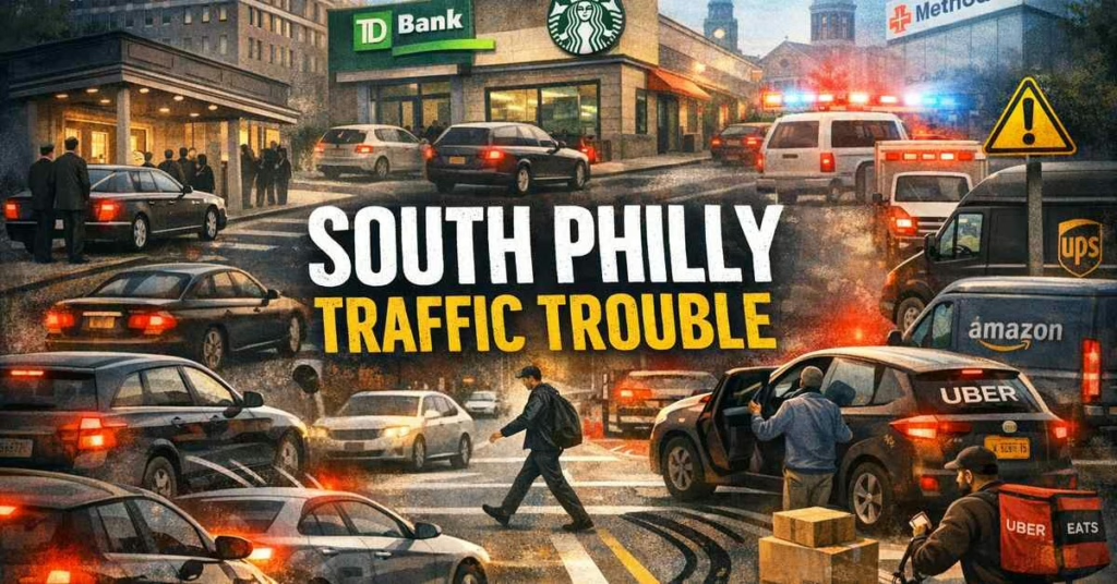
On the east side of Broad Street, about 100 yards down from Jackson, you now have a drive-in TD Bank and a Starbucks—and both come with what changes the street: curb cuts that let cars enter and exit directly onto Broad. That’s not a small detail on this block. When you layer Funeral Parlor Row activity, Southern High in session with students walking, and everyday neighborhood foot traffic, those curb cuts create constant conflict points: cars slowing abruptly to turn in, cars pulling out into moving traffic, and drivers drifting toward the curb while looking for a gap.
Add the real-world behavior—people double-parking “just to run in” for the bank or coffee, or drivers crossing into that entrance area at the curb—and you end up with a stretch where pedestrians can be hidden, lanes get pinched, and routine moves turn dangerous fast. It’s a textbook recipe for a high-risk crash zone: turning conflicts, blocked sightlines, sudden stops, and pedestrians forced to navigate it all at street level.
And there’s another layer that hits this block every day: Uber and Lyft drivers who don’t know the area are often scanning for pickup pins or dropping passengers mid-block, which adds sudden stops and unpredictable curbside movement on top of everything else. At the same time, you’ve got delivery traffic cycling through—Amazon, UPS, Grubhub, and Uber Eats—all working the curb and the cut-ins during the same peak windows. For a deeper, Philly-specific breakdown of how rideshare and delivery traffic changes crash risk, see our article here: Rideshare, Delivery & Gig-Worker Accidents in Philadelphia: What You Need to Know
Broad Street South Philly: Jackson to Snyder
(Carto’s + “Four on One Side” Reality)
Above Gangemi’s, about a hundred yards from the corner of Broad and Jackson was Carto’s Funeral home.
And the crazy thing is four of the five funeral homes were all on the same side of the street.
That’s Funeral Parlor Row: compressed into one corridor that also carries hospital traffic, doctors’ offices, rideshare stops, and today’s center-lane parking behavior.
Because rideshare pickups and drop-offs on Broad can turn routine traffic into sudden-stop collisions, learn your options here: Philadelphia Rideshare Accident Lawyer.
What Happens Today During Viewings and Funerals on Broad Street South Philly
This is where the modern travel problem becomes nitty-gritty, because it’s not theoretical.
Broad Street traffic is so heavy now that curbside parking fills up fast. During funerals and viewings, people arrive in waves. When the curb is taken, the overflow behavior begins:
- Double-parked cars line up for services and viewings
- Drivers stop “for a second” to drop off family
- The center lane between northbound and southbound traffic becomes filled with cars
- Drivers stop in mid-traffic to pull into a spot
- Drivers back up into spaces, forcing sudden braking behind them
That center-lane reality is a major change from “then vs. now.” It creates two problems at the same time:
- Pedestrian visibility collapse: A person stepping off the curb can be hidden by a car in the center lane until the last second.
- Driver conflict zone: Vehicles stop in travel lanes to pull in or back up, causing rear-ends and sideswipes.
This is why so many crashes here are structural—not “bad pedestrians” or “bad drivers.” It’s stacked land use (funeral homes + hospital traffic + neighborhood foot traffic) interacting with a roadway behavior pattern that creates predictable collision conditions.
This article is part of our Philadelphia Neighborhood Safety Guide, which examines traffic patterns and accident risks across neighborhoods throughout the city.
Get Connected with The Oakes Firm
If you’re injured on Broad Street—pedestrian, passenger, or driver—the details matter: where vehicles were stopped, whether center-lane cars blocked visibility, whether double-parking forced a merge, and whether a pull-in/back-up maneuver triggered sudden braking.
Core PhillyLegalConnect Resources
Explore PhillyLegalConnect’s primary guides for rideshare accidents, South Jersey and Jersey Shore injuries, and practical steps to take after an accident.
Philadelphia Neighborhood Safety • Philadelphia Nostalgia • About PhillyLegalConnect • Home
Need legal representation after an accident?
Get Connected With The Oakes Firm →Ultra-Short Snippet FAQs
Is Broad Street South Philly more dangerous today?
Yes—more traffic plus center-lane parking and curb chaos can collapse sightlines and trigger sudden braking.
What’s the biggest risk for pedestrians?
Visibility—center-lane cars and double-parking can hide a person stepping off the curb.
What matters after a crash?
Photos of where every vehicle was stopped/parked (including the center lane), plus the crossing point and lane layout.
FAQs (Broad Street South Philly)
Why is Broad Street South Philly more dangerous now than it used to be?
Because traffic volume plus curb activity plus center-lane vehicle storage creates sightline collapse and sudden braking—especially during Funeral Parlor Row surges and in the Methodist hospital zone.
What’s the biggest pedestrian risk on Broad Street today?
Visibility. Center-lane vehicles and double-parked cars can block a driver’s view of a pedestrian until the last second.
What should I document after a crash on Broad Street?
Photograph where every vehicle was stopped or parked (including center-lane vehicles), your crossing point, any double-parking, and the lane layout—those details often explain the chain of events.
Read More Philadelphia Memories
From South Philly traditions and neighborhood landmarks to childhood games, food, and family stories, explore more memories at the Philadelphia Nostalgia Hub.